In September, I hiked from West Hawk Lake to the town of Rennie, following a 50-kilometre route through the heart of Whiteshell Provincial Park. At West Hawk, my route began by following the South Whiteshell Trail. Then, near Caddy Lake, I joined the Centennial Trail. Both of these trails are part of the Trans Canada Trail network. The trail traces through forests, across creeks, and over Precambrian rock.
West Hawk Lake is a deep circular basin that was formed by a meteor impact 100 million years ago during the Cretaceous Period. Since the lake is 115 meters deep, it is often used for dive training.


I followed the South Whiteshell Trail north from West Hawk. The trail is a wide, gravel path that is well-maintained. There is no mud or obstacles. The two creeks it crosses both have bridges. My first major landmark was West Hawk Lake’s Penniac Bay. Here, there is an informational sign along the lake shore that discusses the history of mining in the region.


As I continued along the trail from here, I actually came across old mining equipment along the side of the trail. Mining in the Whiteshell has been going on since the 1800s. At Star Lake, which is southeast of here, Manitoba’s first gold mine was established.


After examining the old equipment, my next stop was Caddy Lake. I had lunch there and then crossed Highway 44, where the trail connects to the Centennial Trail. Part of this trail also doubles as the Blue Highway Mountain Bike trail. The trail is no longer landscaped with gravel, but traces across granite rock.


About an hour of hiking from Caddy Lake, I encountered McGillvray Falls. The water level was very low, and the falls looked more like a pile of rocks than a waterfall, with only a small trickle of water, enough to refill my water. From here, the trail stayed on top of the granite ridge. At one point, I could look down upon the Lilly Pond, an area where people sometimes rock climb.
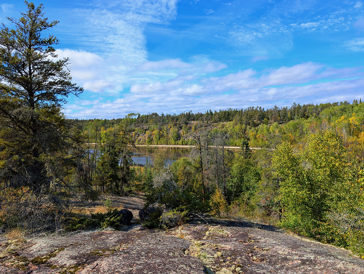

Just as the evening set in, I reached Hanson’s Creek Bridge, which is the halfway point between West Hawk and Rennie. The bridge is a bright red, which stands out amongst the boreal forest backdrop.


Since the sun was going down, I decided to spend the night here. At 2 am, I was awoken by a mink trying to enter my tent.
I left Hanson’s Creek bridge early in the morning. After a few hours of hiking, you could tell that this part of the trail is much less traveled. This wasn’t really surprising, as there are very few landmarks between Hanson’s Creek and Rennie.
On my way to Rennie, I passed by Ross Lake, Teldford Tower, and Jean Lake. At Rennie, the trail comes out right near the Alfred Hole Goose Sanctuary.
I didn’t see any geese at the Goose Sanctuary, but I did see a lot of other wildlife on the trail. There was the mink that tried getting in my tent, then I also saw several garter snakes, prairie chickens, and white tailed deer. Thankfully, I didn’t encounter any bugs, except some mating dragonflies.


enjoyed the article